Testing NASA AMES Stereo Pipeline

Testing NASA AMES Stereo Pipeline

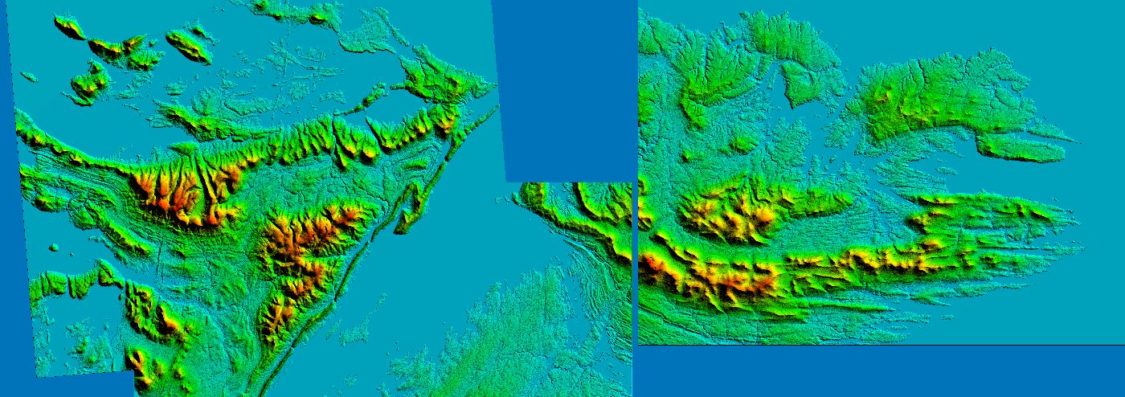
Whilst looking for the best available open source solution to generate terrain heightmaps from satellite stereo pairs, I stumbled upon the results of an international IARPA ‘Multiple view Stereo 3D Mapping challenge‘. The entries that secured 2nd and 3rd place used variation’s of Ames Stereo Pipeine (ASP) NASA’s automated, open-source pipeline for mass production of digital elevation models (DEMs) from very high-resolution commercial stereo satellite imagery. I couldn’t wait to dig deeper and review it’s capabilities. I started by setting up a QGIS project file which allowed me to load up my results from numerous test runs covering every key permutation available for the 2 most successful algorithms, this enabled quick comparison of sometimes subtle differences in results:

SGM (Semi-Global Matching) – a proven stereo algorithm with widesread popularity.

MGM (More Global Matching) – is a variation of SGM that can produce superior output at the cost of longer run-time and higher memory usage.

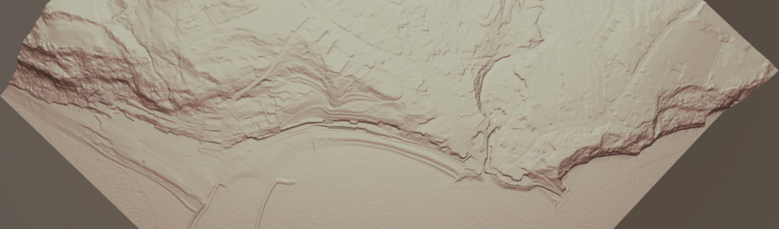
I added a red background on every resulting raster to highlight area’s where the algorithm had not been able to process. Click below image to see animated testing:

Read More
Stitching DEM’s spanning CRS projections in QGIS

Stitching DEM’s spanning CRS projections in QGIS

I didn’t think this was going to be so troublesome! but wanted to note down the steps to resolve.

The ‘Build Virtual Raster‘ process in QGIS will not bring together multiple rasters if they span across 2 CRS projections

Following my initial post of the issue on GIS stackexchange:
https://gis.stackexchange.com/questions/342830/cant-join-multiple-dems-using-qgis-build-virtual-raster-if-they-span-2-crss
A users tip re unifying the projections for loaded data sent me in the right direction.

Read More
Virtual Terrain in Sketchfab

Virtual Terrain in Sketchfab

Despite the limit of 50mb per model uploaded on Sketchfab’s free service, you are able to get a surprising number of Tris within that limit. My Lyme Regis example below has 1.6million!

Flown imagery sourced from Bing, and DEM generated from Defra data.

Looks like Sketchfab are pushing the streaming tech with their new ‘MASSIVE‘ service allowing for 80million Tris+. Obviously this is on a paid service given the underlying models will be huge.

Creating Virtual Terrains with ‘Armory’ Blender plugin

Creating Virtual Terrains with ‘Armory’ Blender plugin

Armory3d is a completely open source game engine that is fully integrated into Blender. Below is my first attempt at stitching a terrain mesh, layered with satellite/flown imagery, making use of the excellent BlenderGIS plugin. You can then simply export the project to an HTML5 application which can run on any browser.

See below a second attempt with some slightly higher resolution sat data, with some improvements to control methods (detailed below). Use WASD keys & left mouse button for controlling camera, sun direction and shadows can also be adjusted with keys – T,Y,G,H,B,N:

Read More