Simulating snow on any terrain

Simulating snow on any terrain

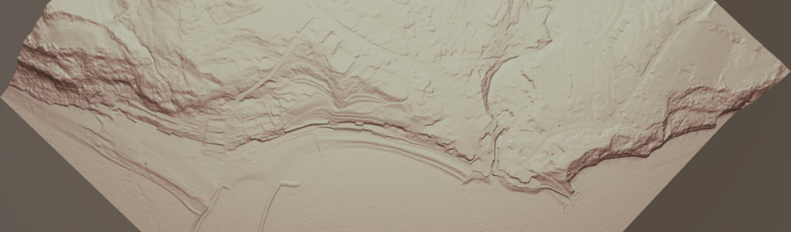
Using Blender (2.90) I created a node group that can add procedural snow to any imported terrain. The node group can be applied with only a few adjustments required to each new environment. This can be controlled on X,Y and Z axis, this is particularly important for the Z axis in order to keep the snow off of the sea.

Open below juxtapose at full resolution

See below the node group required to generate a snow layer:

Read More
Virtual Terrain in Sketchfab

Virtual Terrain in Sketchfab

Despite the limit of 50mb per model uploaded on Sketchfab’s free service, you are able to get a surprising number of Tris within that limit. My Lyme Regis example below has 1.6million!

Flown imagery sourced from Bing, and DEM generated from Defra data.

Looks like Sketchfab are pushing the streaming tech with their new ‘MASSIVE‘ service allowing for 80million Tris+. Obviously this is on a paid service given the underlying models will be huge.

Creating Virtual Terrains with ‘Armory’ Blender plugin

Creating Virtual Terrains with ‘Armory’ Blender plugin

Armory3d is a completely open source game engine that is fully integrated into Blender. Below is my first attempt at stitching a terrain mesh, layered with satellite/flown imagery, making use of the excellent BlenderGIS plugin. You can then simply export the project to an HTML5 application which can run on any browser.

See below a second attempt with some slightly higher resolution sat data, with some improvements to control methods (detailed below). Use WASD keys & left mouse button for controlling camera, sun direction and shadows can also be adjusted with keys – T,Y,G,H,B,N:

Read More